Brief intro to LiDAR

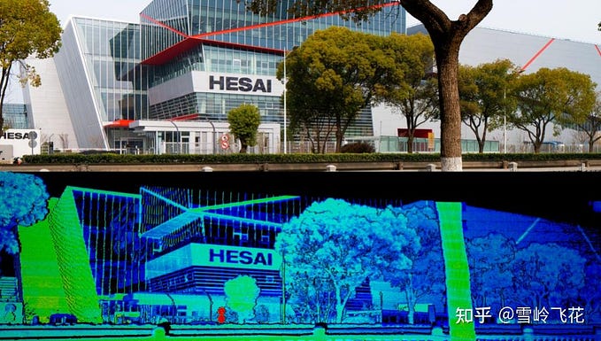
LiDAR or Light Detection and Ranging is an active remote sensing system that is used to measure distances. It sends light pulses to detect any object in the path of light.
How Does LiDAR Work?
LiDAR is an active remote sensing system. A LiDAR system measures the time it takes for emitted light to travel to the ground and back (Time of Flight). That time is used to calculate distance traveled. It generates a point cloud which is 3D representation of the scene.

LIDAR VS RADAR
LIDAR can detect small objects with a short frequency and can see the exact distance, but cannot be used on cloudy or rainy days. RADAR, on the other hand, has a longer working distance than LIDAR and can be used on cloudy days or at night, however, it is difficult to detect small objects and to determine the exact distance.
LIDAR can only predict the position but cannot predict the velocity of a moving object. In SLAM based problems it represents the measurement space in the form of Cartesian coordinates. Radar on the other hand can predict both the position and velocity of moving objects and represents the measurement space in form of Polar coordinates.